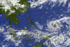
This is the seventh storm to make landfall in the East Sea since the beginning of the year.
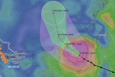
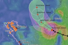
According to the National Centre for Hydro-Meteorological Forecasting, the storm is expected to make landfall in China’s Guangdong Province around midday to late afternoon with sustained winds at level 8, gusting to level 10, before gradually weakening into a tropical depression.
On September 9-10, the northern midland and mountainous regions are likely to experience widespread heavy downpours, with rainfall expected to range between 700-150mm, with some areas seeing totals above 300mm.
Under the storm’s impact, the northwestern East Sea is experiencing strong winds of levels 7-8, increasing to levels 9-11 near the centre, with gusts reaching levels 13, generating waves 4-6m high and causing very rough seas. Vessels operating in these dangerous areas face risks of thunderstorms, squalls, strong winds, and high waves.
The agency warns of downpours exceeding 100mm in just three hours, with thunderstorms likely to unleash tornadoes, lightning, hail, and powerful gusts.
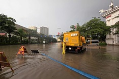
Torrential rains could inundate low-lying areas, urban and industrial zones, while also posing risks of flash floods on small rivers and streams, as well as landslides on steep mountain slopes.