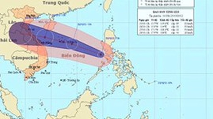
In the next 24 hours, Son Tinh will track west-northwest at a speed of 25kph and gain strength.
At 13.00pm on October 27, the storm is forecast to be centred about 180km east of the central coast from Quang Binh province to Danang city. It will pack winds of between 89-102kph near its centre.
The storm is expected to make a landfall on the north-central coastline of Vietnam.
In its urgent telegram on October 24, the National Steering Committee for Flood and Storm Control asked coastal provinces and cities from Quang Ninh to Ba Ria-Vung Tau and relevant ministries to be well- prepared for the storm.
The designated localities were required to inform offshore fishing vessels of the storm’s track to find nearby storm shelters or travel ashore.


