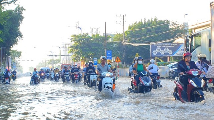
According to the Can Tho Meteorological and Hydrological Station, water levels in local rivers and canals have increased because of the inflow of upstream floods and the peak of high tides over the past two days.

High tides would cause the severe flooding for Can Tho in some days to come
The highest tidal water level recorded at the Can Tho hydrological station on the Hau River was 1.9 metres at 2.30 am on October 14, reaching alert level 2.
The highest water levels in Can Tho’s rivers and canals are expected to continue rising in the coming days, reaching between 2.18 and 2.28 metres, which exceeds alert level 3 by 0.18 to 0.28 metres. This marks a significant increase compared to the record level of 2.27 metres measured on October 12, 2022.
High tides and heavy rains are expected to cause widespread flooding in low-lying and riverside areas of the city.
The Can Tho City People's Committee has requested the Can Tho Meteorological and Hydrological Station to continuously update information on weather and hydrological conditions to give timely warnings to the public, particularly to residents in vulnerable areas.
The Department of Transport has collaborated with relevant agencies to inspect flooded roads and arrange personnel and equipment to manage traffic and provide assistance when necessary.
For central districts, especially Ninh Kieu District, inspections will be carried out on roadways to promptly identify manhole covers and address any safety concerns.


